
Scientific Expedition 2026
INTO THE
INFERNO
A groundbreaking scientific expedition descending into active volcanic zones to unlock the secrets of Earth's most powerful geological forces.

Our Purpose
Mission Overview
We venture where few dare — into the heart of active volcanic systems — to gather data that will redefine our understanding of the planet.
Precision Measurement
Deploy cutting-edge sensors within 200m of active lava flows to collect unprecedented real-time data on thermal dynamics and seismic activity.
Interdisciplinary Team
14 elite scientists spanning volcanology, geochemistry, atmospheric science, and robotics working in concert at extreme altitudes.
Global Impact
Data collected will improve volcanic eruption prediction models, potentially saving millions of lives in high-risk zones worldwide.
Expedition Phases
Research Timeline
A meticulously planned sequence of operations ensuring maximum safety and scientific yield.
Base Camp Deployment
March 2026
Establish high-altitude base camp at 3,200m elevation. Deploy satellite uplinks, medical stations, and equipment staging areas.
Sensor Network Installation
April 2026
Place 47 thermal sensors, seismometers, and gas analyzers in a 5km grid pattern around the primary vent system.
Active Crater Approach
May 2026
Lead team advances to crater rim. Deploy robotic units into the caldera for direct sampling of lava composition.
Atmospheric Sampling
June 2026
High-altitude drone operations measuring SO₂ concentrations, particulate matter, and volcanic aerosol composition.
Data Analysis & Publication
Q3 2026
Comprehensive analysis of all collected data. Initial findings submitted to Nature Geoscience and AGU journals.
Research Focus
The Science
Six interlinked research programs operating simultaneously to maximize the scientific return of every hour in the field.
Thermal Dynamics
Measuring temperature gradients in lava tubes and flow fronts to model heat transfer mechanisms in volcanic systems.
Seismic Precursors
Identifying micro-seismic signatures that precede eruptions by days or weeks — crucial for early warning systems.
Volcanic Degassing
Quantifying SO₂, CO₂, and H₂S emissions to understand magma ascent rates and eruption potential.
AI-Assisted Analysis
Machine learning models trained on real-time sensor data to detect anomalous patterns 40% faster than traditional methods.
Lava Composition
Direct sampling of molten rock to determine mineral composition, viscosity, and volatile content.
Long-term Monitoring
Establishing permanent monitoring stations that will continue transmitting data for 5+ years post-expedition.
Tools of the Trade
Equipment & Technology
State-of-the-art instruments engineered specifically for the extreme conditions of active volcanic environments.
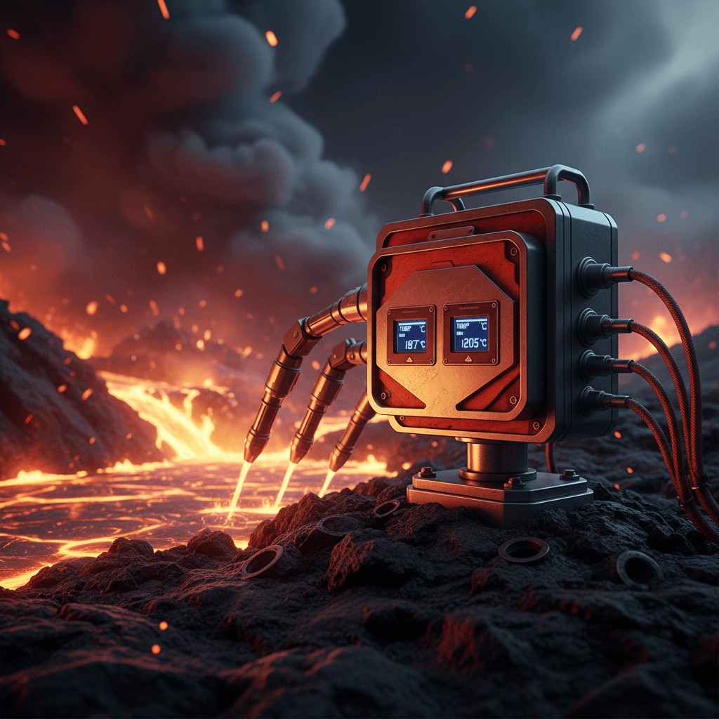
Thermal Sensor Array
Withstands 1200°C. Captures lava flow temperature profiles every 0.1 seconds.
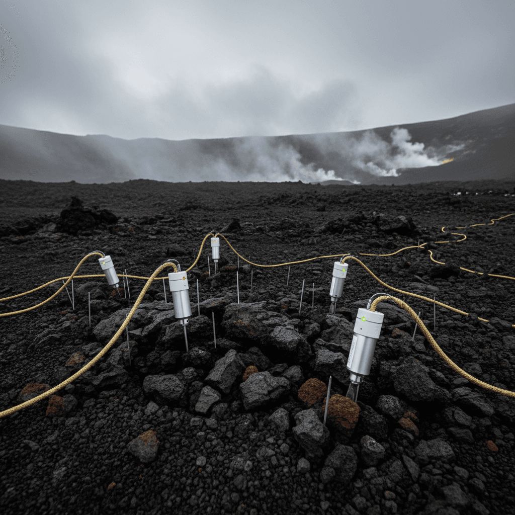
Seismic Network
47-node distributed seismometer network detecting micro-earthquakes as small as M0.1.
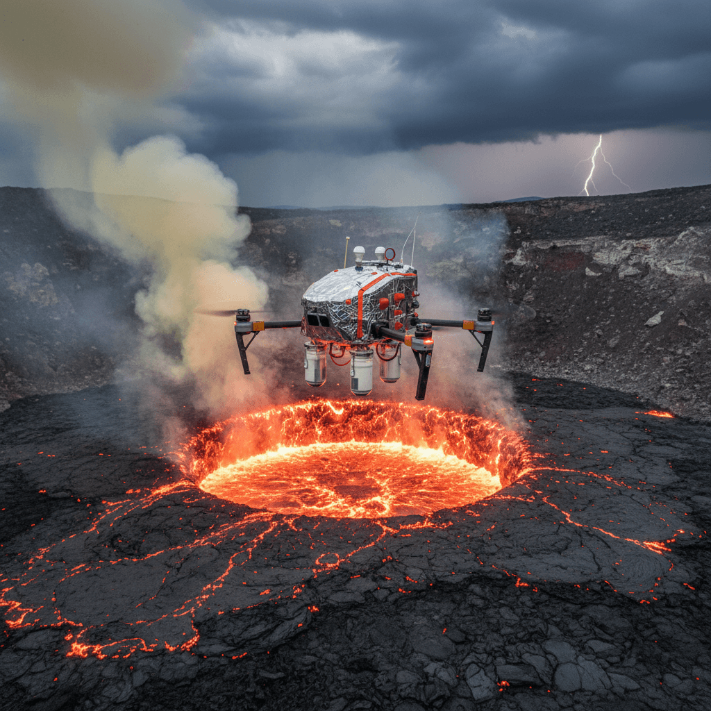
High-Altitude Drones
Heat-shielded UAVs operating at 600°C ambient temperatures, collecting gas samples.
Stay Connected
Field Updates from the Crater's Edge
Subscribe for exclusive dispatches, raw footage, scientific findings, and real-time updates sent directly from our field team.
No spam. Unsubscribe at any time. Scientific updates only.